

RWANDA AUTHORITY TO DEPOLY TECH TO MONITOR ILLEGAL CONSTRUCTION
In Kigali, authorities are in the process of deploying an advanced aero-mapping technology that will be aligned with the Building Permits Management Information System (BPMIS) and the Online Kigali City Masterplan to monitor informal settlements; implying that any construction that is not within the BPMIS will be remotely identified.
When the Senatorial Committee on Political Affairs and Governance, led by Senator Lambert Dushimimana visited the City Hall last week, some of the key issues raised included informal settlements that sprout upneighborhoodsneighbourhoods despite efforts in place to curb them. Senators wanted to know what more the city management is doing to deal with informal settlements.
It was during the meeting that Senators were informed of the new system being developed that will use imagery to identify any informal structure being put up.
In an exclusive interview with The New Times, the city’s Vice-Mayor in charge of Urbanisation and Infrastructure, Merard Mpabwanamaguru gave a detailed insight on the state of informal settlements, progress on the new system, and how it will solve issues related to informal settlements that keep on mushrooming despite the government having invested resources, guidelines and several legal instruments to contain this.
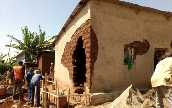
“There are people who persistently put up structures illegally. They construct at night. Most of the houses that are affected by disasters are informal ones. To deal with this, we decided that, in addition to the regular inspections that we do, to come up with satellite-generated images showing us which houses were constructed and their location,” said Mpabwanamaguru.
He added that; “All the permits that we have issued are now georeferenced. All our land and construction systems communicate with each other and they generate data that shows what permit was issued if it is construction or renovation. The data overlays itself on the system and shows you which house is within the issued permit and which one has violated the permit.”
There are cases of people who request renovation permits and end up doing extensions on the house. The system easily detects this. “As we update Cadastral GIS data in the master plan every three months we will be able to see every house that came up, its UPI, and the person it is registered on. The data will be shared with construction inspectors at the sector level and anything that is constructed illegally, is removed,” added Mpabwanamaguru.
This new system is being developed by Esri Rwanda Limited which specializes in ArcGIS software, mapping, and data analytics to deliver location intelligence. Esri Rwanda is connecting the new software to BPMIS and the Online Kigali Masterplan System.
So far, the new system had been tested in the Bumbogo sector of Gasabo District and by next month, Esri will come up with the draft report on the system and by December this year, the system will be complete.
According to Gasabo District Deputy District Executive Administrator, Regis Mudaheranwa, the system comes with a lot of advantages that will address many issues causing informal settlements.
“The system will have several advantages, we will have quick means to access construction information, effective storage of data, and also accountability in following up all cases reported on the system, ” said Mudaheranwa.
The use of the new satellite imagery system will indeed allow Kigali to link geographic locations with accurate socio-economic data, which is a powerful tool in planning human settlements be they formal or informal
Josephine Malonza, a lecturer at the school of Architecture, University of Rwanda, believes that the use of Technology in settlement planning and coordination is one of the effective antidotes in addressing informal settlements in rapid urbanization.
“With technology, the city can generate data quickly, to inform policy in good timing. We have always wondered why urbanization runs at cheetah-speed while urban planning and policy formulation walks at chameleon-speed! Technology is, therefore, a great intervention to this gap,” she said.
Malonza who describes herself as an architect and urban designer with a keen interest in the dialectical relations between Architecture and Society also says that the new technology will help in analyzing the growth and changes in informal settlements which are a quite dynamic phenomenon and more often than not with limited data for planning.
“The other good thing about technology is that it will also have in place a monitoring component that combines both special and social data. Informal settlements are home to the most socially and economically vulnerable people in a city, a common feature in most developing countries. Therefore, many interventions are always welcome about improving the living conditions of people living there. I believe that the first step is designing with people for people,” she said.
The development comes a year after Rwanda Land Management and Use Authority (RLMUA) issued guidelines on informal settlement.
In an October 2021 interview with The New Times, the Director-General of RLMUA Espérance Mukamana said that the lack of clear guidelines had led to the increase of informal settlements in the country.
Reports indicate that over 61 percent of the Rwandan population currently live in informal settlements and plans are underway to have them relocated to well-planned settlements.
The country’s population is projected to increase nearly two-fold by 2050; from the current 12 million to 22 million people, according to estimates from the National Institute of Statistics of Rwanda (NISR).
According to estimates by Rwanda Housing Authority, the country needs at least 5.5 million housing units up from 2.5 million units in 2019 to accommodate an estimated 22 million people in 2050.
It is projected that 90 percent of Kigali dwellers will be living in formal settlements by 2050.