- HOW TEMANE-MAPUTO ELECTRICITY TRANSMISSION LINE PROJECT IS GOING THROUGH TEST IN MOZAMBIQUE
- NAMIBIA INAUGURATED FIRST PLASTIC RECYCLING PLANTS
- PROGRESS MADE ON PIIM PROJECTS AS OVER 85% COMPLETED IN ANGOLA
- WORLD BANK KICK-OFF INSPECTION OF USMID PROGRAM IN UGANDA
- ALGERIA MINISTER RECIEVED HARBOR ENERGY CEO OVER ENERGY PARTNERSHIP


HOW TO CREATE A SITE PLAN USING AUTOCAD

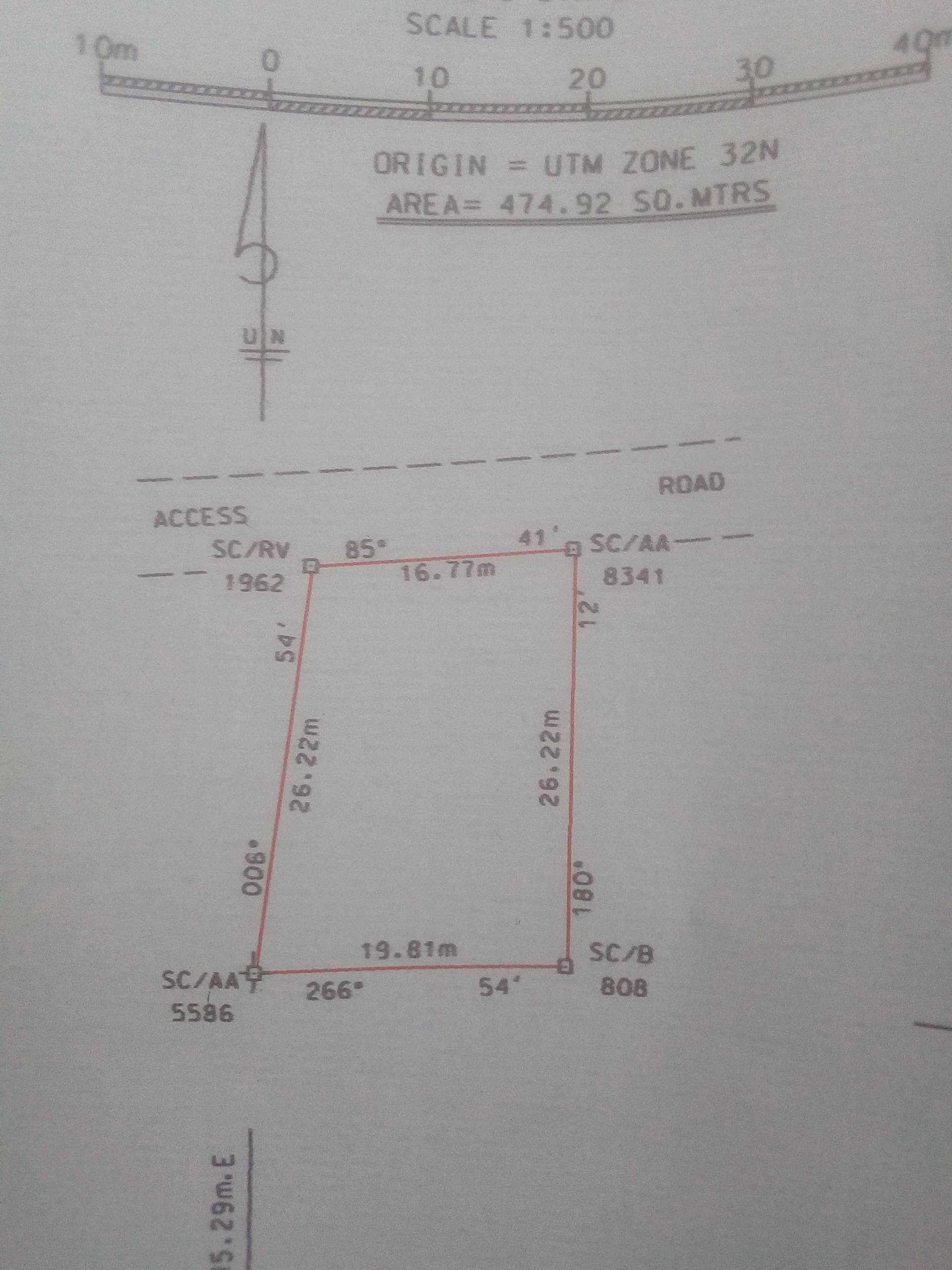
When you hear the word survey plan, the first thing that comes to you mind are building, Surveyors but it is much more than that. The plan is a document that measures the boundary of a parcel of land to give an accurate measurement and description of that land.
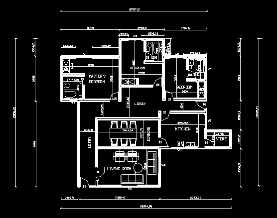
The Survey plan is a document that guides the Architect and Civil engineer on how a specific building can be built. This document is vital because from it, the Architect can draw the site layout or plan.
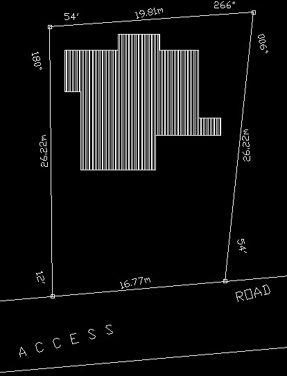
The site plan shows the layout of a property or site. It includes the location of buildings and structures plus also other features like driveways, walkways, landscaped areas, gardens, pools or water, trees, terraces and more.
STEPS
Get a survey plan that is already approved by the government to avoid any future problem with the law.
Design or get a drawing from either a professional Architect or Civil Engineering firm.
Open a new document on your Autocad file.
Use the dimension of the Survey plan to create your site plan.
Start by clicking on your polyline on your drawing toolbar.
Pick a point and type @Length of the first point< degree and min. E.g @13300<85d12”
Do the same for all points.
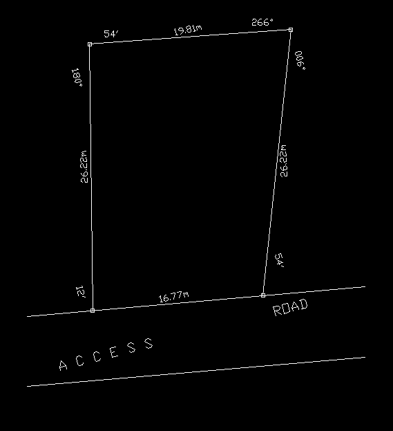
Pick point on your building plan then place it on your Site plan according to your specification. Meanwhile, Distance from wall to building must be at least 1200mm because of your roof.
Drop your comments and feedback about the topic.
Click the floating icon on the right to subscribe. More so, please share, follow us on Twitter and don’t forget to also like us on Facebook.